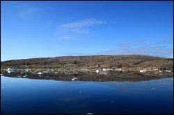
Tasiusaq – meaning “the lake-like bay” – is the second largest settlement in the Upernavik district and is located on a relatively large island 71 km north of Upernavik. In 1805, a few colonists were ‘put’ there to run the trade and net fishing, but Tasiusaq was not formally considered a trading station until the late 1800s. The original dwelling was located on a cape one kilometre west of the trading buildings.

The settlement is characterised by scattered development, which covers a long area along the south-facing shore. Farthest to the east lies a natural harbour for dinghies and small boats. A smaller cape, where the former production facility was located, separates the natural harbour from Tasiusaq’s newer port and industrial area, which features a power plant and new quay facilities and makes better use of the large water depth in the area.
The settlement’s centre area, which includes, e.g., a shop, a post office and a jetty, is centrally located between three surrounding residential areas towards the east, north and west, respectively. From it extends a system of roads that links the three residential areas to the central part of the settlement.
Provisions and subareas
The general provisions apply to all subareas of the municipalities in towns, settlements and open country areas. The provisions are general and do not consider the local conditions in the subareas.
General provisions of the Town Plan
The overall provisions for each subarea are the basis for the municipality"s granting of area allotments and building permits.
The aim is to maintain the current level of service and housing. Further urban development is to take place within the existing settlement area.
In the settlement, business development should be strengthened, primarily by improving the conditions for sustainable fishing and production, including new initiative, and by improving port facilities, e.g. by establishing a new boat workshop and bedding. In addition, it should be possible to establish new land-based trade. The industrial area should be extended northwards to cover the cape.
Residential construction to replace homes ready for redevelopment is one option, and there are ample opportunities for new building. Citizens clearly voice a need for child-care institutions, indoor leisure facilities and infrastructure, including water supply, lighting, new wheel tracks and waste management solutions, which also affect the health of the settlement. It should also be considered to relocate the dump.
Tasiusaq’s population has grown since 1980 when it numbered 163 inhabitants. In 2000, the population reached 231, and in 2017 the number increased further to 267 inhabitants in the settlement.
The development structure of the settlement consists of detached single-family houses, and homes are mainly located along the south-facing coast line. The remaining residential capacity of the settlement is estimated at 30 homes.
The main trades in Tasiusaq are sealing, whaling, Greenland halibut fishing and production of dried strips of halibut. The production facility in the settlement is, nonetheless, only used as freezing facility. The port in Tasiusaq features a jetty with a quay length of 5.5 metres and a water depth of around 2.5 metres. An area almost 400 meters off the harbour dock is designated by Naalakkersuisut as a port authority area.
Jobs are related to Upernavik Seafood A/S, Pilersuisoq A/S, the service house, the settlement consultation post, the municipal office, a privately owned trading facility for fresh skin, Nukissiorfiit, the privately owned refuse collection company and the school. Tourism also generates jobs. By 2015, the unemployment rate in the rural areas of the Upernavik district was 10.9% overall. This is slightly higher than Upernavik, where the unemployment rate was 9.3%. Likewise, it is slightly higher than both the municipal average (9.1%) and the national average (9.1%).
There is no remaining capacity for industry.
The helistop is located north of the settlement, but no roads go there. Other transport is by sea, by means of either dog sledge or snowmobile.
The primary settlement road runs across the settlement, from the east to the west. A number of small roads extend from it. In general, the infrastructure is to be made more cohesive and there is a need for both new and better roads.
Nukissiorfiit handles the technical operation of power, heat and water supplies. Water supply consists of extracting water from drinking water lakes, or of melting pieces from small icebergs. Water can be collected at bottling houses. Tasiusaq is unsewered apart from the service house, and grey wastewater is discharged directly above ground. Nigh soil is discharged into the sea using a ramp with a chute. Telecommunication is handled by TELE Greenland A/S.
The municipal administration building was constructed in 2002, and the building also holds the activity centre and the settlement consultation post. The service features a hall with adjoining kitchen, toilet and shower facilities as well as a small laundry. Furthermore, there are two senior homes and organised home-help services. Child-care services consist of family day care.
The settlement’s elementary school, Tasiusap Atuarfia, was extended in 2011 and numbers around 42 pupils in forms 1 through 9.
Tasiusaq includes five preservation-worthy buildings – B-81, B-83, B-89, B-102, B-107 and B-202 – and include, among other things, the old trading buildings.
The hall in the service house acts as the settlement’s village hall, forming the primary settings of the cultural and association activities in the settlement. Other leisure activities are related to the surrounding nature.


