


Ukkusissat is the fourth largest settlement in the Uummannaq area and is located some 50 km north of Uummannaq. The settlement is situated on a rolling, north-sound running terrain of rocks between the coast and the mountains. Further inland, 25 km to the northeast, lie Maamorilik and the Black Angel mine.
Provisions and subareas
The general provisions apply to all subareas of the municipalities in towns, settlements and open country areas. The provisions are general and do not consider the local conditions in the subareas.
General provisions of the Town Plan
The overall provisions for each subarea are the basis for the municipality"s granting of area allotments and building permits.
As a minimum, the current level of service and housing in Ukkusissat is to be maintained. The goal is to further strengthen and develop fishing and tourism, and to encourage citizens to return to the settlement after finishing their education elsewhere. In particular, the existing tourism activities should be supported, e.g. by improving common areas, redevelopment of empty houses and offering an active cultural scene. The older preservation-worthy buildings in the settlement could also be used to this end. The settlement’s children and youth are to be given better opportunities: day care, recreational activities, playground, soccer field etc. Furthermore, the municipal functions should be gathered in one location.
The population of Ukkusissat increased until 2000 to 230 persons. Since then, the population has gone down considerable, dropping by 35 per cent to 149 inhabitants (January 2017). The planning period is primarily expected to call for replacement buildings in connection with redevelopment, both in terms of senior housing and family homes. The population is evenly distributed in terms of age, however, the settlement has few men aged 30-39 years, and a relatively large group of people aged 40-44 years.
The settlements of Uummannaq total 509 homes (2010 figures), primarily detached single-family houses in one to 1½ storeys. Many houses are in need of rehabilitation or development, and some are empty. In 2017, the settlements numbered 367 households and a total of 981 inhabitants. This corresponds to an average household size of 2.7 persons per household, which is the same as in the town of Uummannaq and slightly less than the municipality average in Avannaata Kommunia (2.8). The settlement has no retirement home.
Future urban development is to take place by extending the two existing town plan areas. Also, a new residential area has been zoned north of the settlement. The remaining capacity of the residential areas is estimated at around 35 homes.
The inhabitants mainly work in the fishing trade, and Greenland halibut are caught for Royal Greenland’s production facility in the settlement. The factory can receive 4.5 tonnes/day and its freezing store can hold 100 tonnes. The number of employees ranges from one to ten, depending on the season.
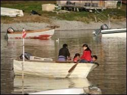
The southern part of the settlement has a quay and small boats make fast in the bay east of the port. Dinghies are hauled on to the beach by the bay. From here, Naalakkersuisut has designated a smaller area as a port authority area.
Jobs are also related to service, the shop, the school, the municipal activities and tourism. For instance, the settlement is often visited by small cruisers.
The seven settlements in the Uummannaq district had a total unemployment rate of 6.7% in 2015, which is lower than for the town Uummannaq (7.8%). The Uummannaq settlements, as well as the Ilulissat settlements, both have a total unemployment rate of 6.7%, which is Avannaata Kommunia's lowest. The unemployment rate is therefore also lower than both the municipal average (9.1%) and the national average (9.1%).
In the town plan, the remaining capacity for industry and port facilities is around 13,000 m².
The helistop is located north of the settlement. Other transport is by sea and by snowmobile or dog sledge.
A north-south-running road extends from the dump in the north to the fish factory and the port in the south. In the northern end, a wheel track leads onwards to the helistop, and the central road section through the settlement has side roads that lead into the residential areas, to the school etc. In several places, Ukkusissat’s roads are more like paths.
The overall technical operation is handled by Nukissiorfiit. The houses are heated by means of private oil burners, and the power plant is located by the sea, close to the oil tank installations. In the summer, water is supplied by a river south of the settlement and collected in a winter water tank with bottling facilities. Day-time refuse is deposited and burned at the dump north of the settlement. The settlement is unsewered, but night soil is collected and discharged into a creek feeding into the sea.
Telecommunications is handled by TELE Greenland A/S.
The municipality runs an office in a small building near the service house, port and the shop. The settlement also boasts a shop, a nursing station, a village hall, a service house, a dressmaking business and a few kiosks, along with a community workshop.
The elementary school (Atuarfik Pilerfik) numbers around 25 pupils in forms 1 through 9. Recreational club activities are held on the school premises, which also include a library.
The church is located centrally in Ukkusissat, next to the cemetery. Other cultural and leisure activities usually take place in the school and village hall. Public outdoor activity areas (playground and soccer field) are in severe need of maintenance.
The settlement includes the following preservation-worthy buildings: (B-104) warehouse from 1907, (B-109) warehouse from 1867, (B-111) warehouse from 1906, and (B-313) dressmaking business from around 1930. The buildings make up a preservation-worthy building environment, which is a distinct feature along the beach in the southern end of the settlement, close to a drying/boat hauling area.
